All-Sky imagery at Earth Modeling Branch: |
Purpose
|
Gallery
|
Cases
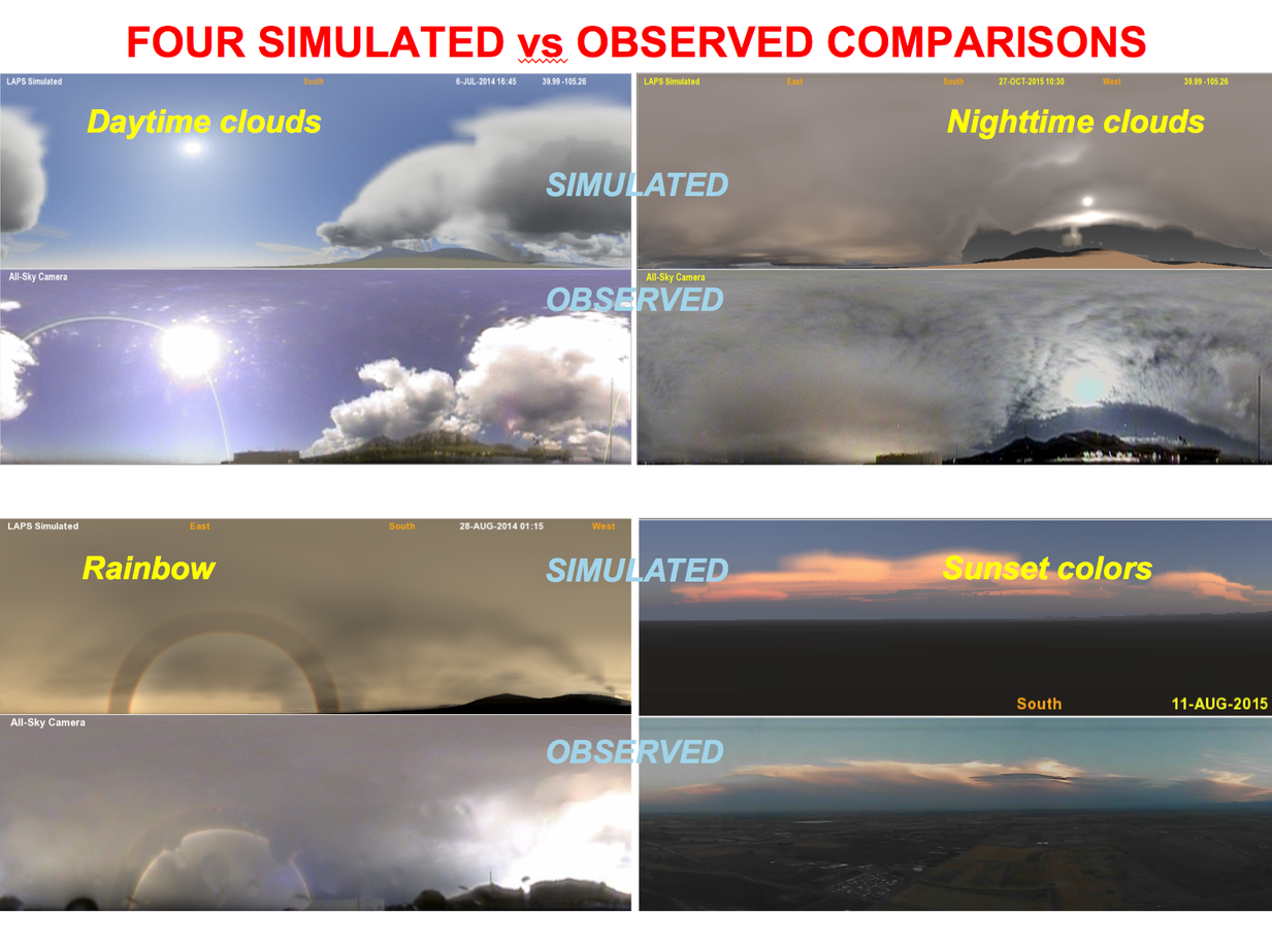
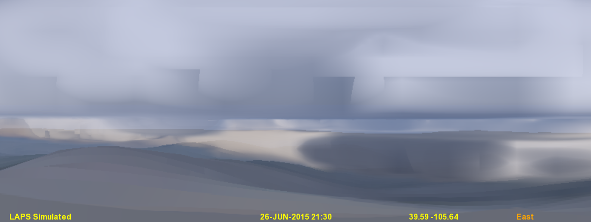
The LAPS system is being used to produce rapid update, high resolution analyses and forecasts
of clouds and weather. We are now producing realistic sky (and land) simulations from these weather analyses and forecasts.
The 3-D cloud analysis, running over our
Colorado 500 meter resolution domain
uses satellite (including IR and 1-km resolution visible imagery, updated every 5-min), METARs, radar, aircraft and model first
guess information to produce an hourly 3-D field of cloud fraction, cloud liquid, and cloud ice.
The analysis is then converted using a ray-tracing technique into an all-sky image. Here are some links with more details in this
seminar,
this
AMS presentation
and this
satellite conference poster.
A recent
ESRL news story
on this work has been posted. Portions of this package are also being tested with the HRRR and FIM models.
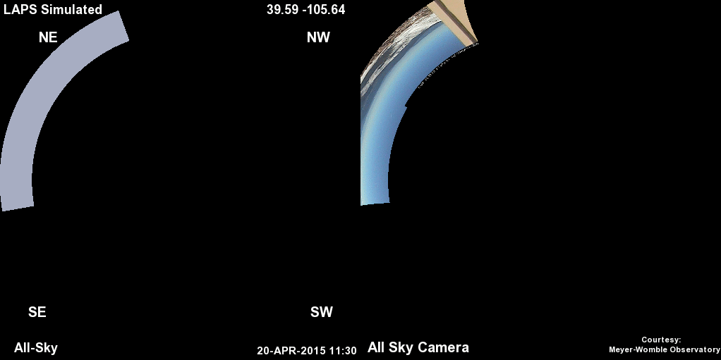
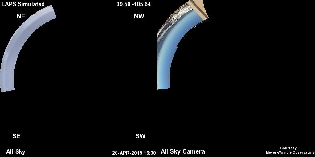 The image above on the left is simulated from the LAPS cloud analysis and other data,
while the image on the right is from a webcam maintained by the University of Denver's Meyer-Womble Observatory atop Mount Evans, Colorado
at the same time. In each fisheye lens view the zenith is in the center and north is up.
The color balance of the simulated image is set to reproduce the "actual" colors/radiances when the display white point is set to closely match the sun.
Thus to see a true apples to apples comparison (if for example you take your computer outside or right by a window), please set
your display to a color temperature of 5780K (the sun's white color above the atmosphere).
Some images are shown a bit dark to avoid saturating and losing details on the bright end. This can be compensated for by turning up your monitor
brightness, thus showing a broader dynamic range.
The image above on the left is simulated from the LAPS cloud analysis and other data,
while the image on the right is from a webcam maintained by the University of Denver's Meyer-Womble Observatory atop Mount Evans, Colorado
at the same time. In each fisheye lens view the zenith is in the center and north is up.
The color balance of the simulated image is set to reproduce the "actual" colors/radiances when the display white point is set to closely match the sun.
Thus to see a true apples to apples comparison (if for example you take your computer outside or right by a window), please set
your display to a color temperature of 5780K (the sun's white color above the atmosphere).
Some images are shown a bit dark to avoid saturating and losing details on the bright end. This can be compensated for by turning up your monitor
brightness, thus showing a broader dynamic range.
Latest all-sky comparison
image
|
mask
(site is MTEVANS)
Latest comparison animations
(site is MTEVANS):
Polar
|
Cylindrical
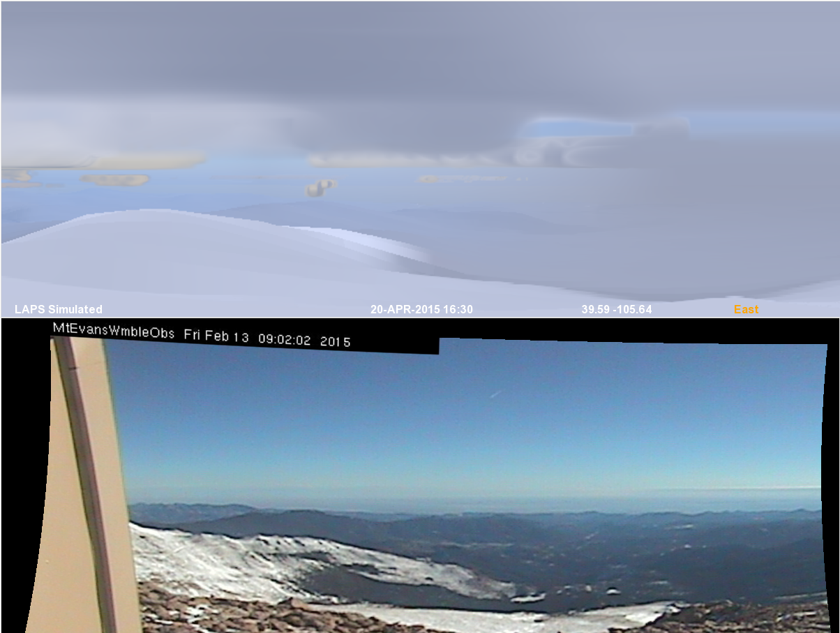 In these views, the top is a simulated LAPS image and bottom is a remapped camera image
from a webcam maintained by the University of Denver's Meyer-Womble Observatory atop Mount Evans, Colorado.
South is at the center of each image and north is at the edges.
The listed solar irradiance is calculated from the same radiance information used to construct the image.
In these views, the top is a simulated LAPS image and bottom is a remapped camera image
from a webcam maintained by the University of Denver's Meyer-Womble Observatory atop Mount Evans, Colorado.
South is at the center of each image and north is at the edges.
The listed solar irradiance is calculated from the same radiance information used to construct the image.
Latest Simulated image
|
Latest Camera
image
|
animation
(site is MTEVANS)
|
Sample forecasts:
(Kansas Storms)
|
(Moore Tornado)
Archive Directories
(site is MTEVANS):
Polar Comparison
|
Cylindrical Comparison
|
Cylindrical Simulated
|
Verification
Contact:
Steve Albers
(Steve.Albers@noaa.gov)