Large versions of individual mosaics
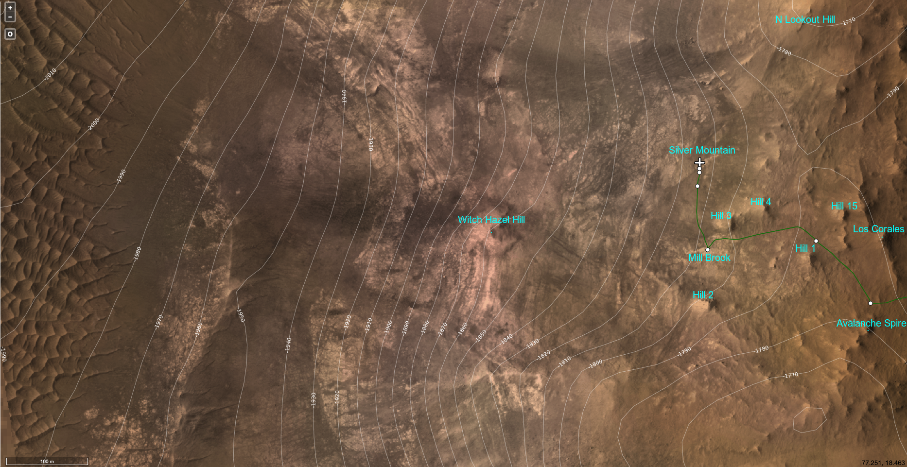
Map 1 (Lookout Hill closeup 1.5-km wide)
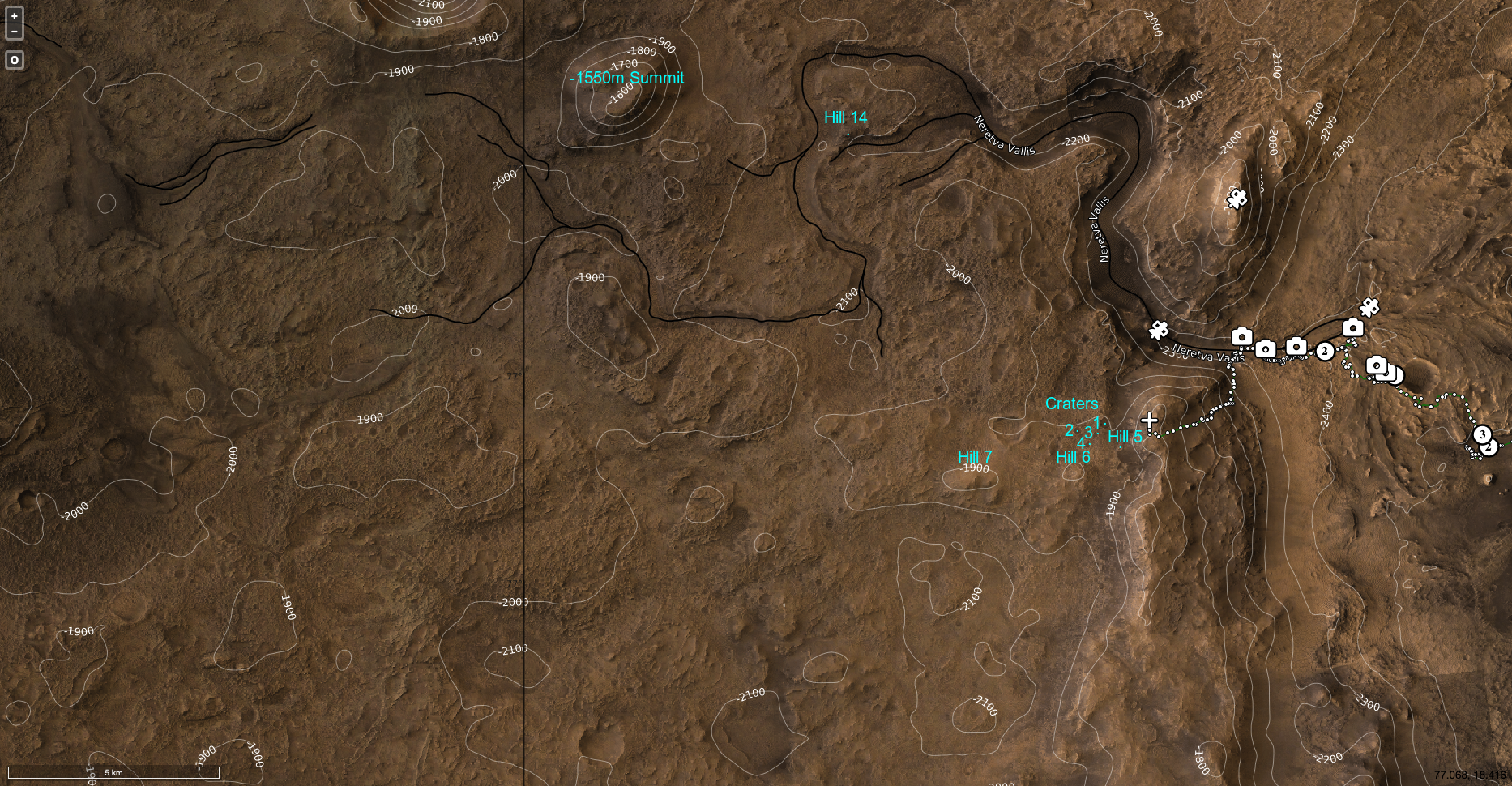
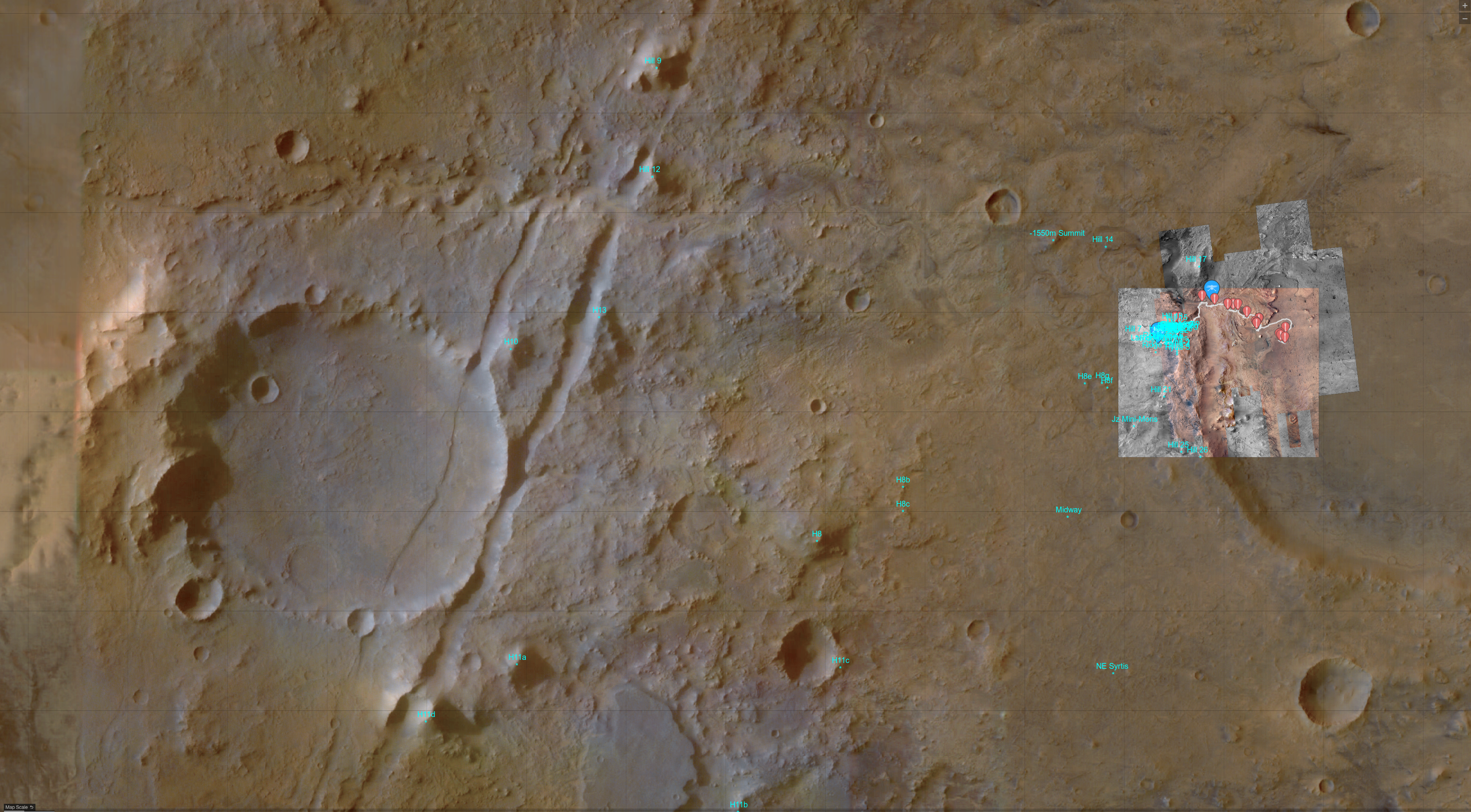
Map 2 (medium/large region 35-km wide, features visible from Crater Rim)
Map 3 (large region 100-km wide)
Map 4 (Lookout Hill, Woodstock, Fallbreen)*
Map 5 (outside Jezero rim traverse 5-km wide)
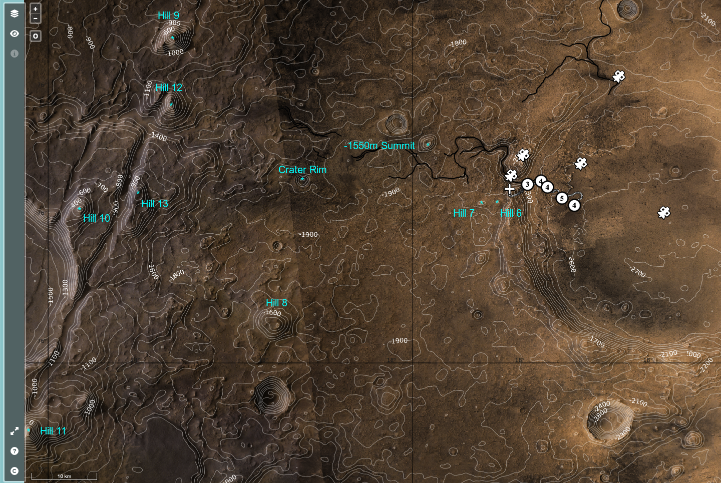
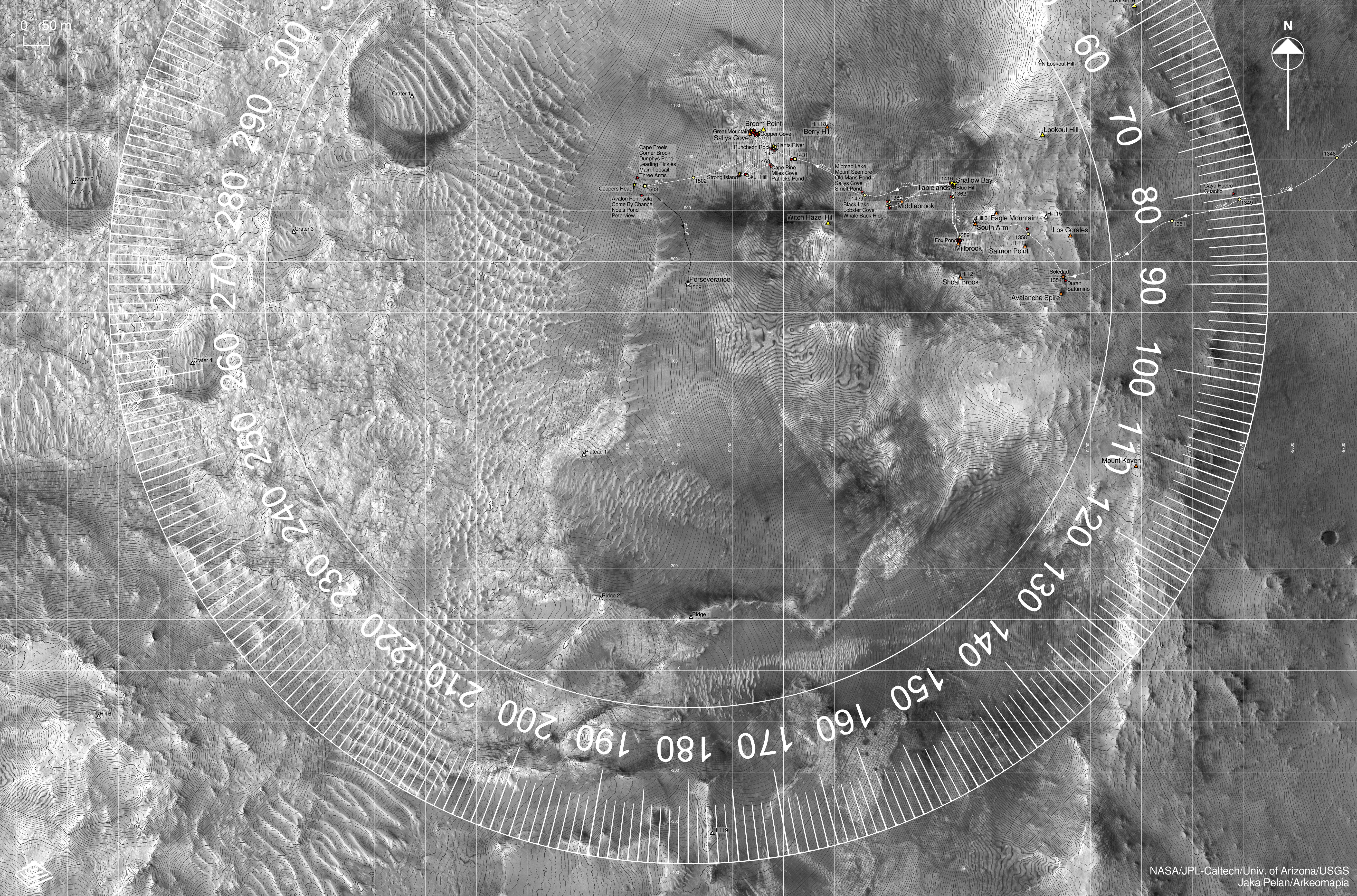
Map 6 (largest region 130-km wide)
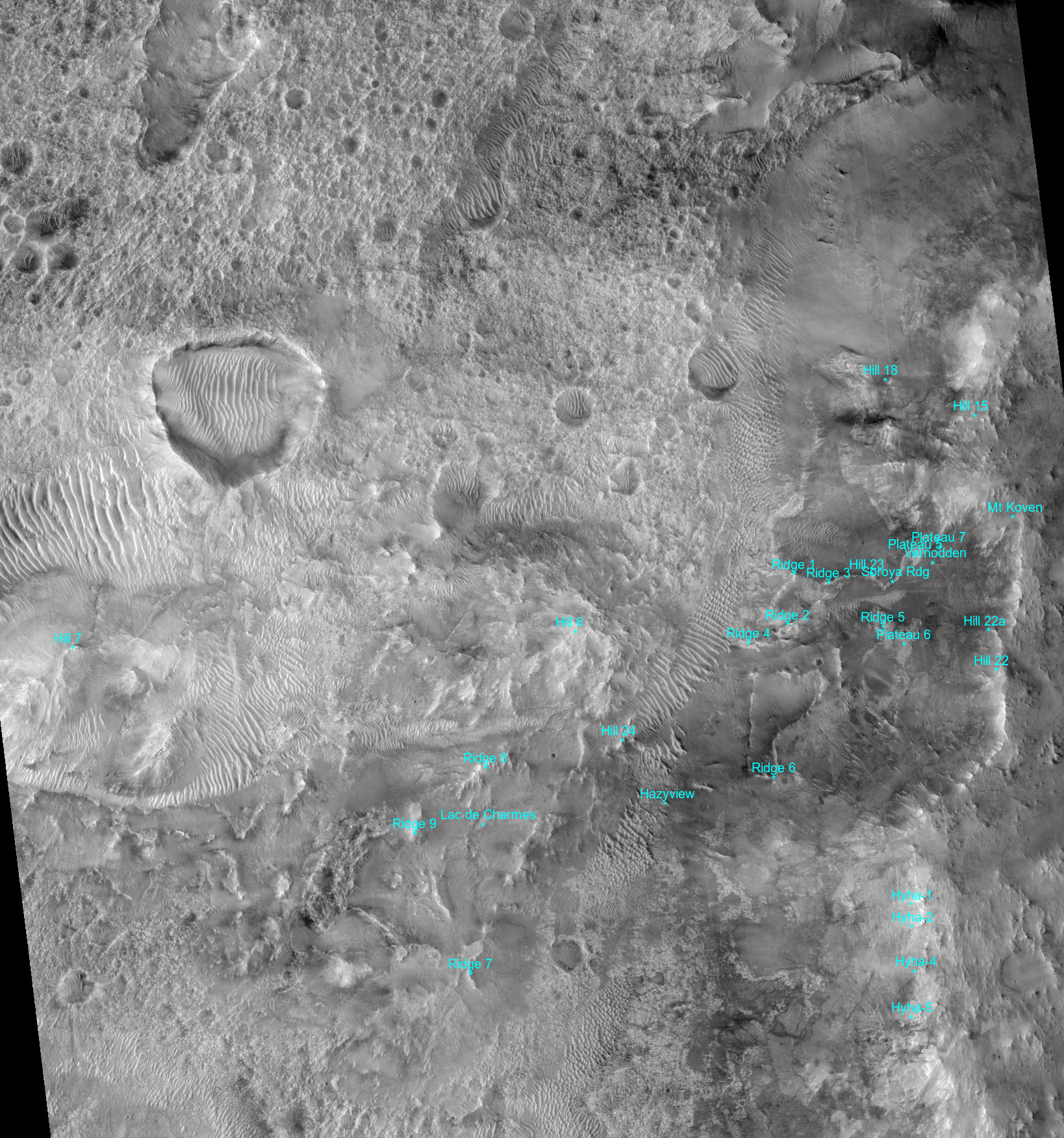
Map 8 (medium/large region 35-km wide)
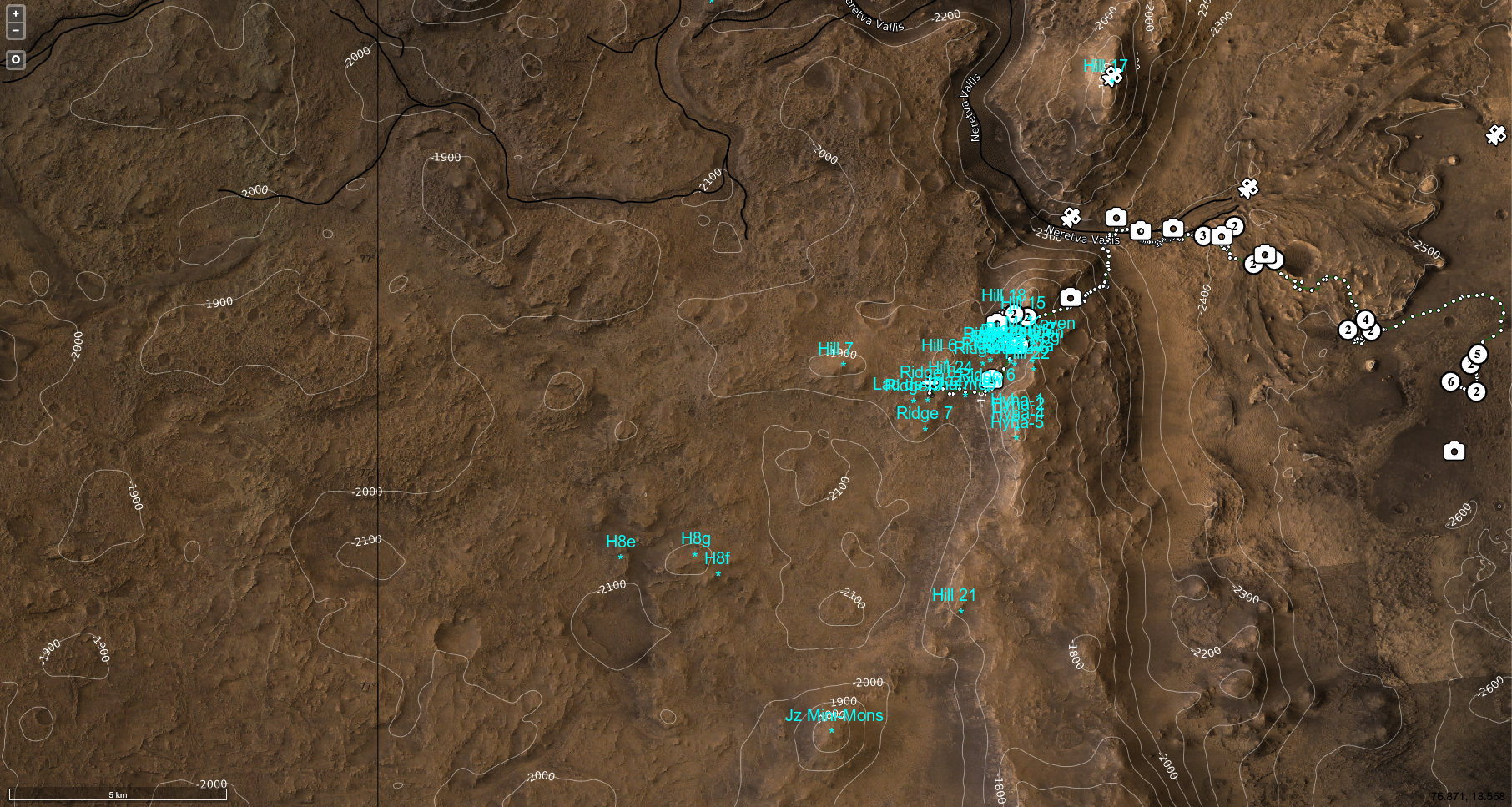
Map 9 (medium region 20-km wide - on top of DTM)**
* basemap and annotation courtesy Jaka Pelan / Arkeomapia
** DTM courtesy of USGS
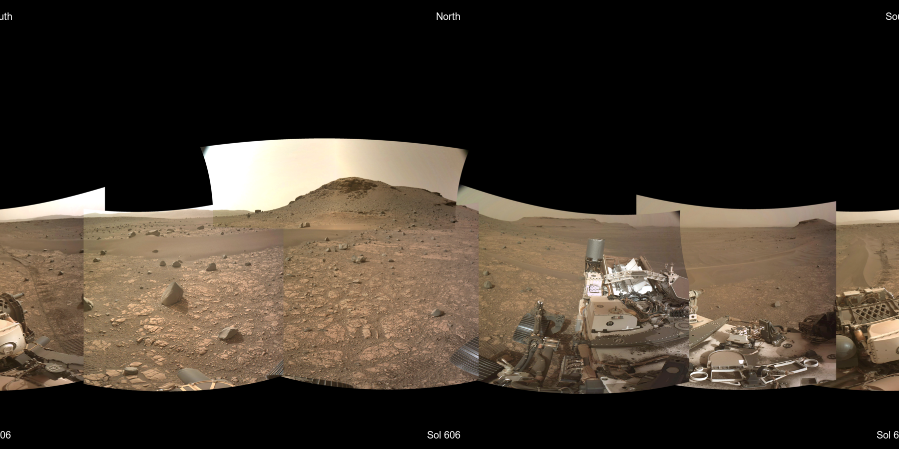
The annotated mosaics below are generated automatically using rover and feature coordinates (lat,lon,elevation). Features hidden by others in the foreground are omitted with an experimental 3D masking, based on the terrain horizon elevation angle and distance.
Sol 1578 | Sol 1584 | Sol 1593 | Sol 1595 | Sol 1597 | Sol 1601 | Sol 1606 | Sol 1647 | Sol 1674 | Sol 1675 | Sol 1676 | Sol 1686 | Sol 1688 | Sol 1690 | Sol 1698 | Sol 1701 | Sol 1703 | Sol 1704 | Sol 1710 | Sol 1756 | Sol 1765 | Sol 1779 | Sol 1815 | Sol 1893 | Sol 1900