
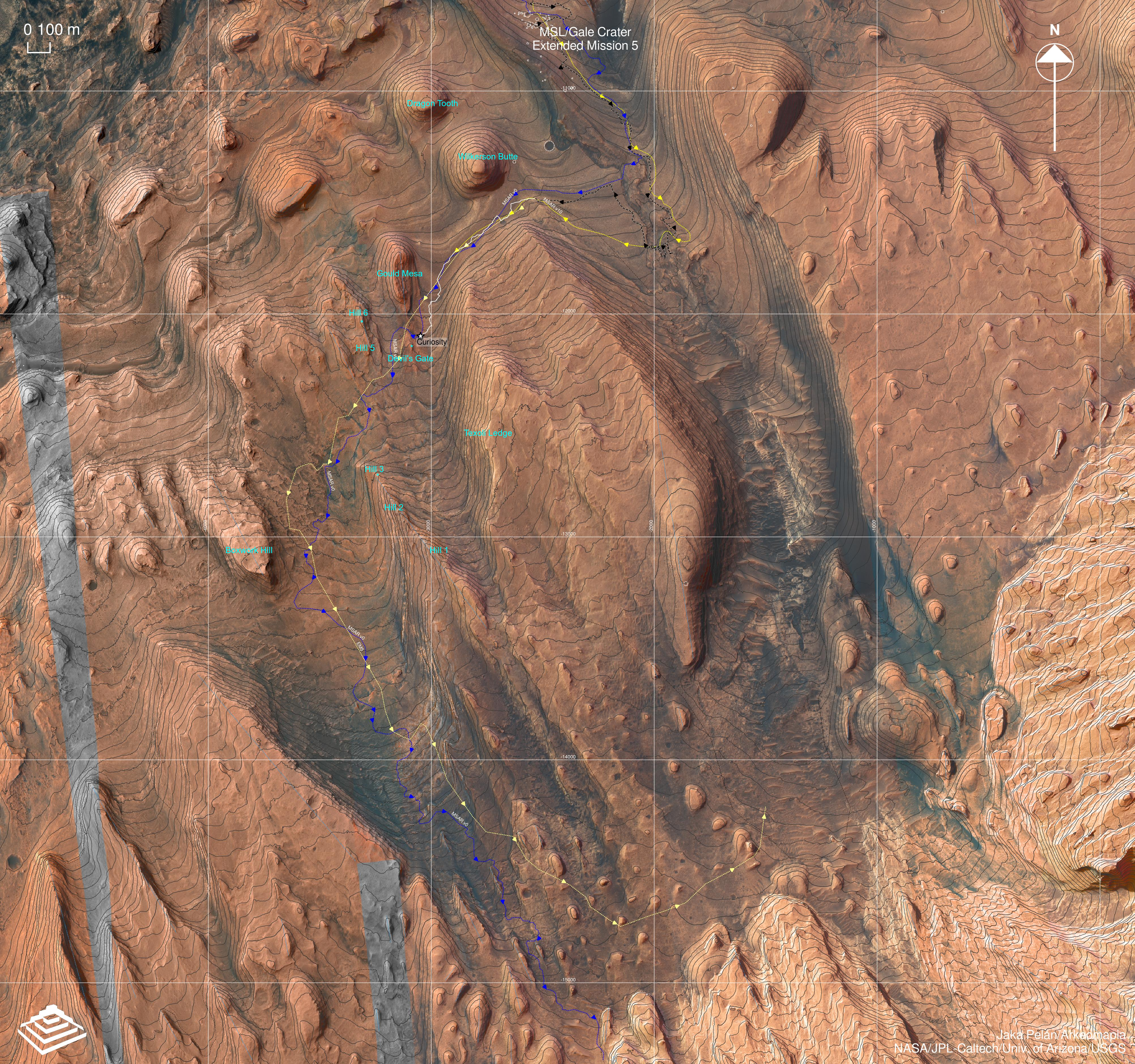
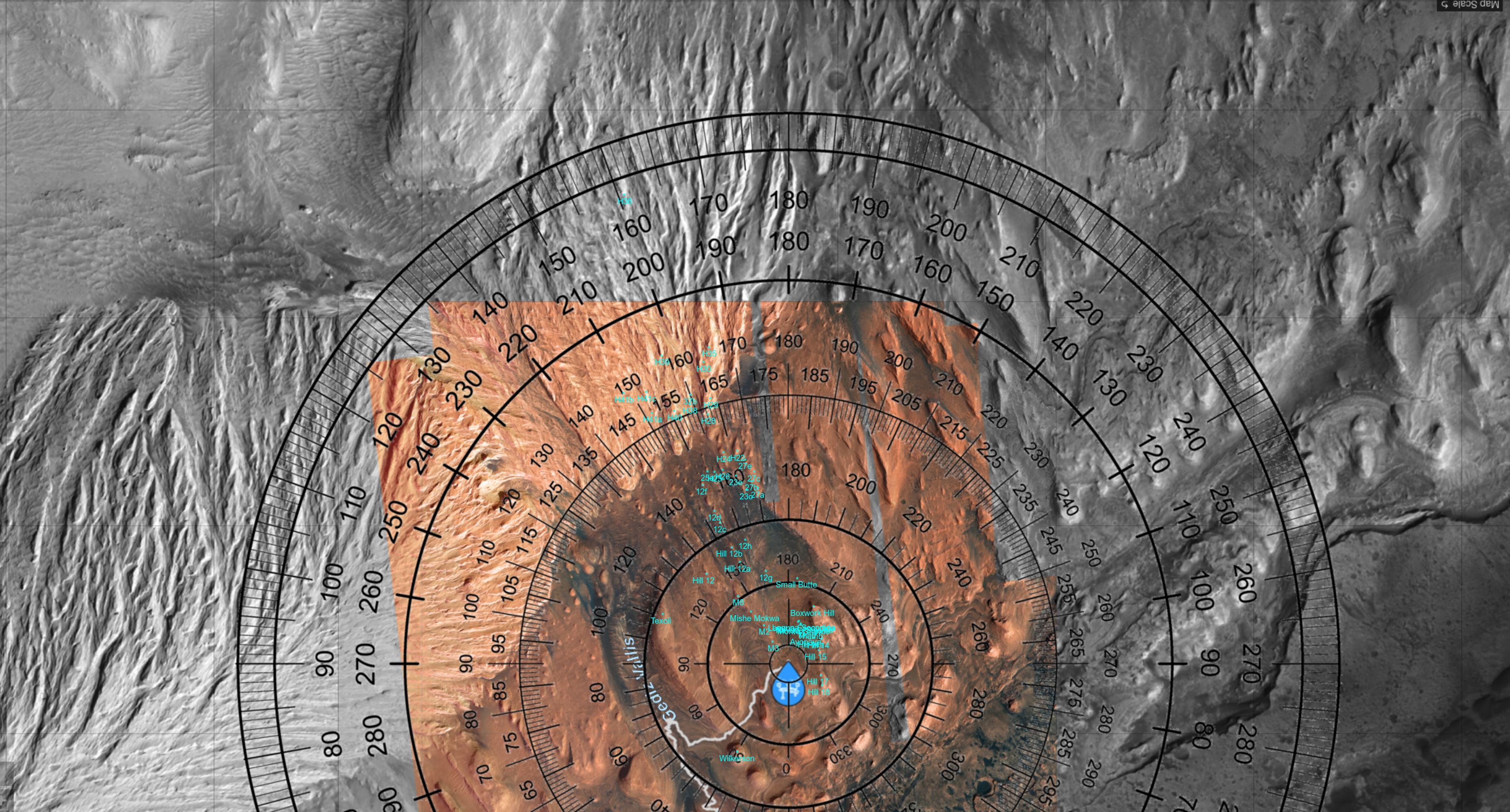
Map 1 (Texoli, Boxwork, Cordillera region)*
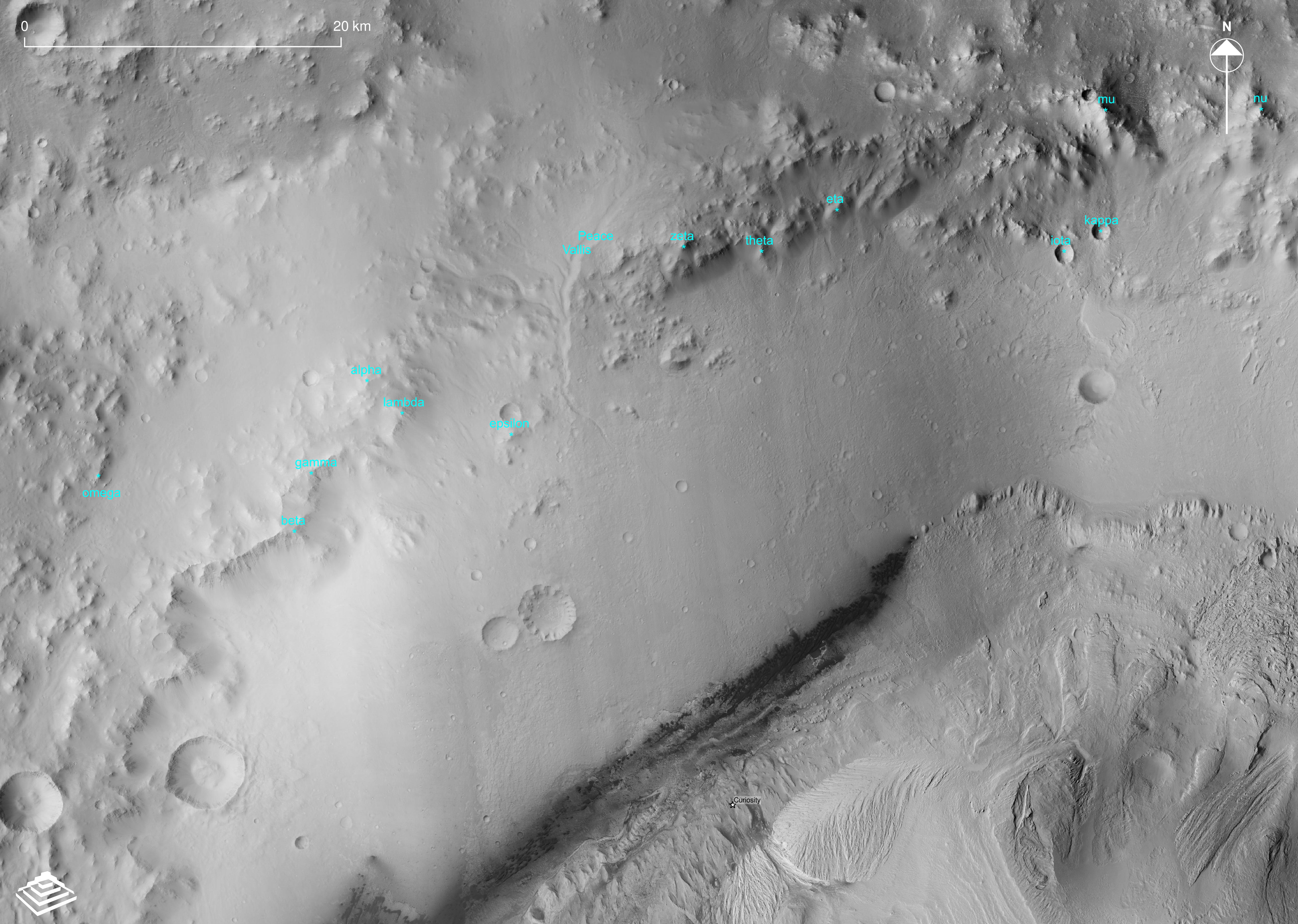
Map 2 (crater rim)*
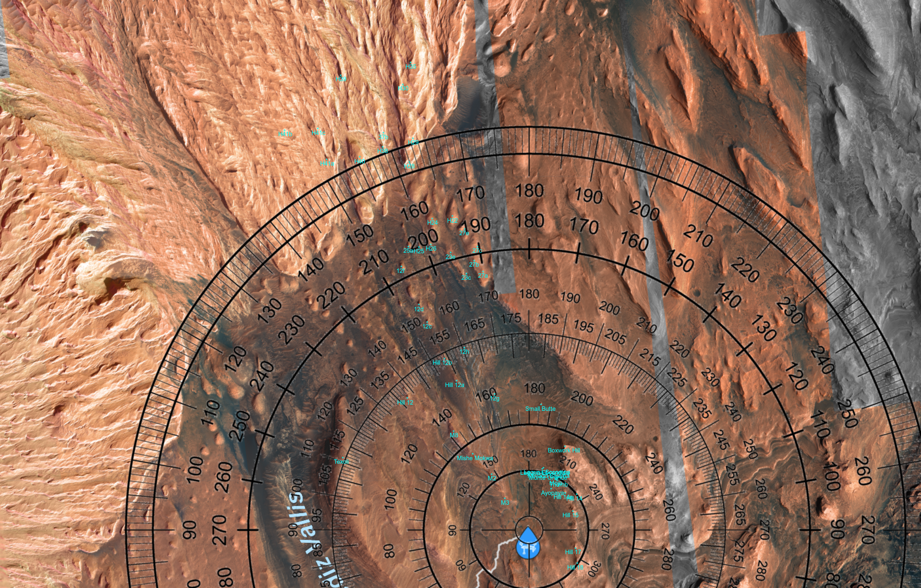
Map 3 (crater rim - extended)**
Map 4 (Mt. Sharp highlands)
Map 5 (Mt. Sharp highlands - extended)
* basemap courtesy Jaka Pelan / Arkeomapia
** basemap and annotation courtesy Jaka Pelan / Arkeomapia
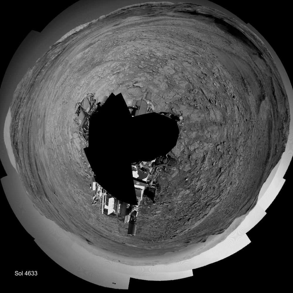
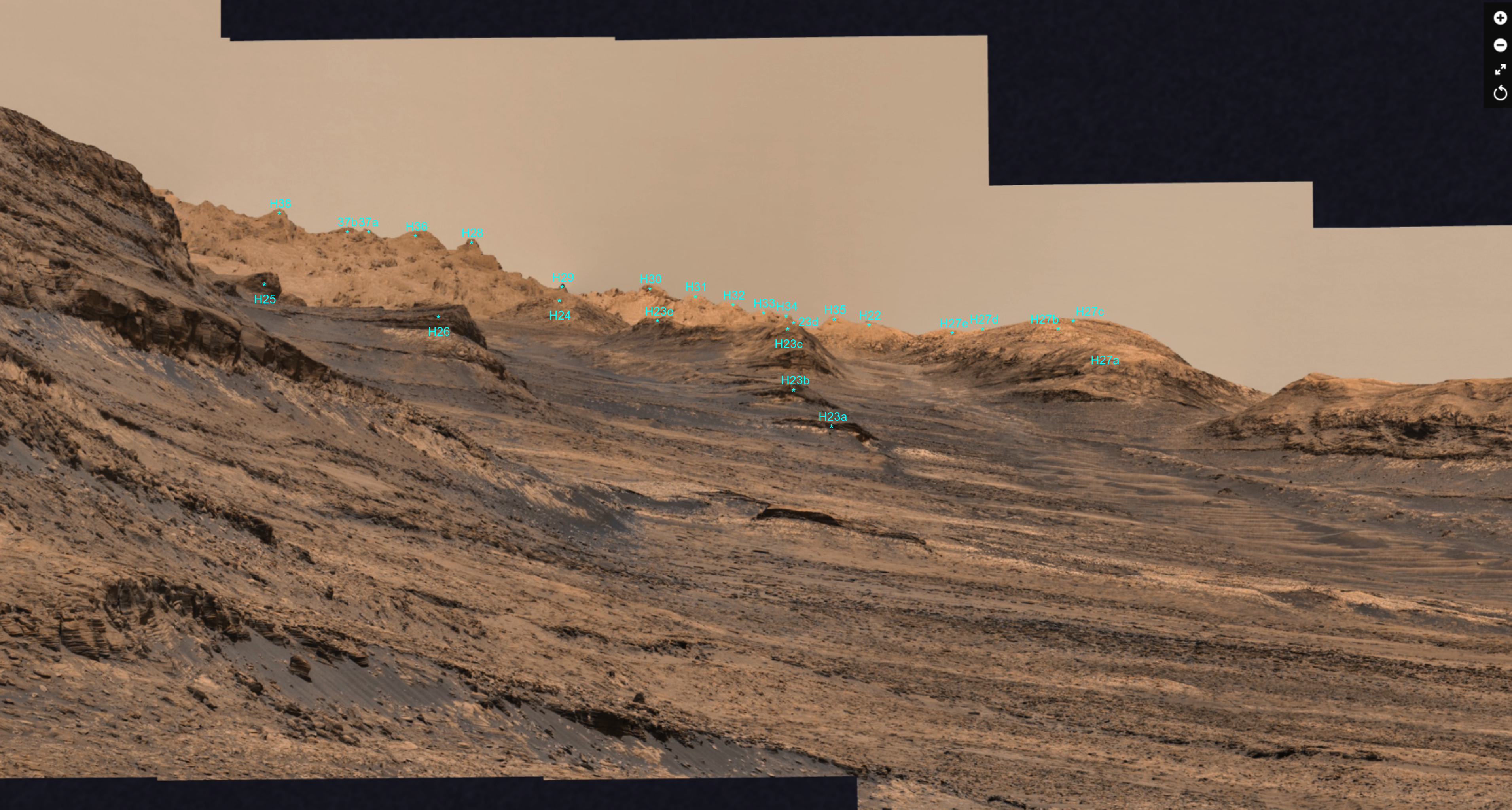
The annotated cylindrical mosaics up to Sol 4558 were done with a largely manual process. Starting on Sol 4641 they are generated with more automation using data on rover and feature coordinates (lat,lon,elevation). Features hidden by others in the foreground are omitted with an experimental 3D masking, based on the terrain horizon elevation angle and distance.
Here's a special one using a Gigapan MastCam mosaic courtesy of Neville Thompson. Sols 4563-4570